Introduction to the Topic
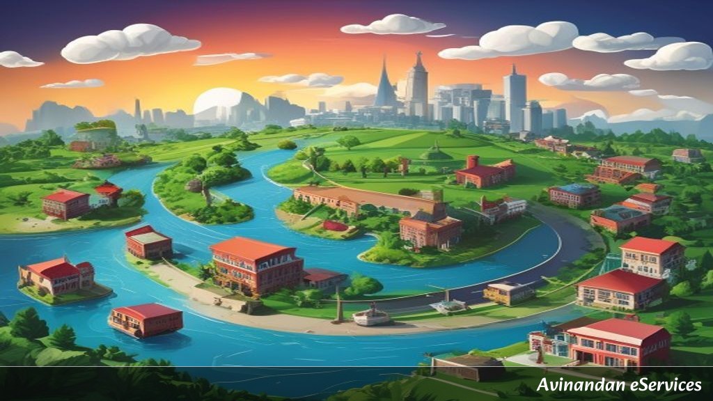
In physical geography, the term drainage refers to the river system of an area. Imagine the Earth's surface as a giant landscape where rainfall flows down natural channels, merging into smaller streamlets, which in turn feed into major rivers that eventually empty into vast bodies of water such as lakes, seas, or oceans. Class IX Geography Chapter 3, titled Drainage, provides a comprehensive overview of India's river networks, their geological origins, distinct patterns, ecological roles, and economic importance.
Understanding drainage is vital not only for geography examinations but also for developing a holistic view of human civilization. Major cities, agricultural heartlands, and industrial centers across India have historically flourished along riverbanks. From the snow-fed streams of the Himalayas to the rain-fed rivers of the Deccan Plateau, India's drainage system is a fascinating subject that defines the country's topography, climate, culture, and economic prosperity.
Key Concepts Explained
1. Basic Terms and Drainage Patterns
Before diving into specific river systems, it is essential to master fundamental geographical terms:
- Drainage Basin: The total area drained by a single river system (a main river along with all its tributaries) is called its drainage basin. The Amazon River forms the world's largest drainage basin, while in India, the Ganga basin holds this distinction.
- Water Divide: Any elevated area, such as a mountain range or an upland, that separates two adjoining drainage basins is known as a water divide. For instance, the elevated tract around Ambala acts as a water divide between the Indus and the Ganga river systems.
- Drainage Patterns: Depending on the slope of the land, underlying rock structure, and climatic conditions, streams form distinct geometrical patterns:
- Dendritic Pattern: Resembles the branches of a tree. It develops where the river channel follows the slope of the terrain over uniform rock strata (e.g., rivers of the northern plains).
- Trellis Pattern: Forms where hard and soft rocks exist parallel to each other, and primary tributaries join main streams at right angles.
- Rectangular Pattern: Develops on a strongly jointed rocky terrain with sharp right-angled bends.
- Radial Pattern: Forms when streams flow outward in different directions from a central peak or dome-like structure (e.g., rivers originating from the Amarkantak plateau).
2. Himalayan Rivers vs. Peninsular Rivers
India's drainage systems are broadly divided into two major groups based on their origin, age, and flow characteristics:
- Himalayan Rivers: These rivers originate from the snow-capped Himalayan mountain ranges. They are perennial, meaning they flow throughout the year because they receive water from both rainfall and melting glaciers. They have long courses, perform intensive erosional activity in their upper reaches, cut deep V-shaped valleys and gorges, and form elaborate meanders, oxbow lakes, and expansive deltas in their lower courses. Examples include the Indus, the Ganga, and the Brahmaputra.
- Peninsular Rivers: Originating mostly from the Western Ghats or the central highlands, these rivers are older and predominantly seasonal, as their flow depends almost entirely on rainfall. During the dry season, even large peninsular rivers experience reduced water flow in their channels. They have shorter and shallower courses compared to their Himalayan counterparts. Examples include the Godavari, Krishna, Kaveri, Mahanadi, Narmada, and Tapi.
3. The Himalayan River Systems
The three principal Himalayan river systems are defined by their long journeys and \textensive tributary networks:
A. The Indus River System
The River Indus originates in Tibet, near Lake Mansarovar. Flowing westward, it enters India in the Ladakh region, carving spectacular gorges. Its prominent tributaries in Jammu and Kashmir include the Zaskar, Shyok, Nubra, and Hunza. Moving further south into Pakistan, it receives the combined waters of five major Punjab rivers—the Jhelum, Chenab, Ravi, Beas, and Satluj—at Mithankot before discharging into the Arabian Sea east of Karachi. With a total length of 2,900 km, the Indus is one of the longest rivers in the world. Under the Indus Waters Treaty (1960), India is allocated 20 percent of the total water carried by the Indus river system, used mainly for irrigation in Punjab, Haryana, and western Rajasthan.
B. The Ganga River System
The Ganga originates as the Bhagirathi from the Gaumukh glacier and is joined by the Alaknanda at Devprayag in Uttarakhand, from where it is known as the Ganga. It emerges from the mountains onto the plains at Haridwar. The Ganga is joined by major tributaries from the Himalayas, such as the Yamuna (originating from Yamunotri), Ghaghara, Gandak, and Kosi. The Yamuna runs parallel to the Ganga and meets it at Prayagraj (Confluence/Sangam). Tributaries from the Peninsular uplands include the Chambal, Betwa, and Son, which originate from semi-arid zones with shorter courses and less water content.
Flowing eastward through West Bengal, the river bifurcates at Farakka. The Bhagirathi-Hooghly distributary flows southwards through deltaic plains to the Bay of Bengal, while the main stream flows south into Bangladesh, joined by the Brahmaputra, to form the Meghna. Together, they create the Sundarban Delta, the world's largest and fastest-growing delta, renowned for the Bengal tiger and mangrove forests. The total length of the Ganga is over 2,500 km.
C. The Brahmaputra River System
The Brahmaputra rises in Tibet, east of Lake Mansarovar, slightly north of the sources of the Indus and Satluj. Known in Tibet as the Tsangpo, it carries a smaller volume of water and less silt due to the cold and dry climate of the region. On reaching Namcha Barwa (7,757 m), it takes a dramatic 'U-turn' and enters Arunachal Pradesh through a gorge, where it is called the Dihang. Joined by tributaries like the Dibang and Lohit, it enters Assam as the Brahmaputra. Here, receiving high monsoon rainfall, it carries vast amounts of water and sediment, leading to continuous channel shifting and the formation of riverine islands, including Majuli, the world's largest inhabited riverine island.
4. The Peninsular River Systems
Peninsular India features two primary sets of rivers based on their direction of flow, determined by the central water divide formed by the Western Ghats:
A. East-Flowing Rivers (Drain into the Bay of Bengal)
- The Godavari System: Originating from the slopes of the Western Ghats in the Nashik district of Maharashtra, the Godavari is the largest Peninsular river (approx. 1,500 km). Due to its immense length and basin coverage across Maharashtra, Madhya Pradesh, Odisha, and Andhra Pradesh, it is fondly termed the 'Dakshin Ganga' (Ganga of the South). Its main tributaries include the Purna, Wardha, Pranhita, Manjra, Wainganga, and Penganga. It forms a fertile delta before entering the Bay of Bengal.
- The Mahanadi System: Rises in the highlands of Chhattisgarh and flows through Odisha to reach the Bay of Bengal (length: 860 km). Its basin is shared by Maharashtra, Chhattisgarh, Jharkhand, and Odisha.
- The Krishna System: Rising from a spring near Mahabaleshwar, the Krishna flows for about 1,400 km. Key tributaries include the Tungabhadra, Koyana, Ghataprabha, Musi, and Bhima.
- The Kaveri System: Originates in the Brahmagiri range of the Western Ghats and reaches the Bay of Bengal south of Cuddalore in Tamil Nadu (length: 760 km). Its main tributaries are Amravati, Bhavani, Hemavati, and Kabini. The river forms India's second-largest waterfall, Shivanasamudram Falls.
B. West-Flowing Rivers (Drain into the Arabian Sea)
- The Narmada System: Rises in the Amarkantak hills in Madhya Pradesh. It flows westward through a rift valley formed due to faulting. The Narmada creates striking natural features, such as the 'Marble Rocks' near Jabalpur and the 'Dhuadhar Falls' where the river plunges over steep rocks.
- The Tapi System: Rises in the Satpura range in the Betul district of Maharashtra. It also flows in a rift valley parallel to the Narmada but is shorter in length. Its basin covers parts of Madhya Pradesh, Gujarat, and Maharashtra.
- Note on West-Flowing Streams: The coastal plains between the Western Ghats and the Arabian Sea are very narrow, resulting in short west-flowing coastal rivers like Sabarmati, Mahi, Bharathappuzha, and Periyar. These rivers form estuaries rather than deltas.
5. Lakes in India and Their Significance
Lakes are of immense value to human beings and physical ecology. They vary significantly in size, origin, and seasonal behavior:
- Freshwater Lakes: Mostly situated in the Himalayan region, these are predominantly of glacial origin (formed when glaciers dug out a basin filled later by snowmelt). The Wular Lake in Jammu and Kashmir is the largest freshwater lake in India and originated due to tectonic activity. Other key freshwater lakes include Dal Lake, Bhimtal, Nainital, Loktak (Manipur), and Barapani (Meghalaya).
- Saltwater Lakes: Formed in arid/semi-arid inland drainage areas, such as the Sambhar Lake in Rajasthan, which is used for salt production.
- Coastal Lagoons: Formed when spits and bars enclose saltwater along the coasts, such as Chilika Lake (Odisha—India's largest saltwater lagoon), Pulicat Lake, and Kolleru Lake.
- Artificial Lakes: Created by damming rivers for hydel power generation and irrigation, such as Guru Gobind Sagar (Bhakra Nangal Project).
6. Role of Rivers in the Economy and River Pollution
Rivers have been fundamental throughout human history. Water from rivers is a basic natural resource essential for domestic use, agriculture, power generation, and navigation. In a country like India, where agriculture is the primary livelihood for a vast population, river irrigation plays an indispensable role.
However, heavy municipal, industrial, and agricultural demand has severely affected water quality. Uncontrolled discharge of untreated sewage and toxic industrial effluents into river streams exceeds the natural self-cleansing capacity of water bodies (such as the Ganga's ability to assimilate pollution within a 20 km stretch). Recognizing this crisis, the Indian government launched initiatives like the Ganga Action Plan (GAP) in 1985, expanded under the National River Conservation Plan (NRCP), and the comprehensive Namami Gange Programme to clean and restore national river basins.
Summary & Key Takeaways
- Drainage Concept: Refers to the river network of an area, bounded by water divides and categorized into distinct drainage patterns (dendritic, trellis, rectangular, radial).
- Himalayan Rivers: Perennial, long courses, active erosion, melting snow source (e.g., Indus, Ganga, Brahmaputra).
- Peninsular Rivers: Seasonal, dependent on rainfall, shorter courses, mature valleys (e.g., Godavari, Krishna, Kaveri, Mahanadi, Narmada, Tapi).
- East vs. West Flowing: East-flowing rivers form deltas along the Bay of Bengal; major west-flowing rift-valley rivers (Narmada, Tapi) form estuaries in the Arabian Sea.
- Lakes: Range from tectonic/glacial freshwater lakes (Wular, Dal) to coastal lagoons (Chilika) and saline inland lakes (Sambhar).
- Conservation: River pollution due to urban sewage and industrial runoff requires active remediation through government programs like the National River Conservation Plan (NRCP).